Location: The dangerous section of Longwan bridge in Foshan city and the harbors of Taishan power station in Tangshan bay, Taishan city
Date: April 25-28, 2018
Instrument: Oceanalpha M40 multi-purpose unmanned boat
Beijing Anderson Changchun 3DSS-DX-450 3D side scan sonar
Beijing Zhuhai Putonghua MS-400 multibeam sounding system
User: Guangdong Banting Survey Technology Co., Ltd.
Instruments overview:
In this mission, the M40 unmanned boat is deployed with a 3DSS-DX-450 3D side scan sonar, an MS-400 multibeam sounding system, a wave master navigation system and a wireless broadband antenna. Receiving mission commands from the base station, the unmanned boat controls the above instruments to conduct the bathymetric survey and submerged geomorphology detection automatically.
Case details
Survey area
The mission includes watercourse survey and harbor basin survey.
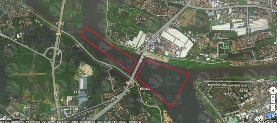
The survey area includes both the upper and lower reach of the Longwan bridge and is of approximately 1 square kilometer and the water depth ranges from 2 to 5 meter.
2.Harbor basincircumstance
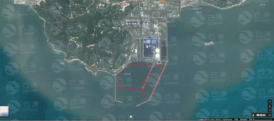
Survey areas in Taishan harbor (The red frame area)
The basin is within in the Taishan power station harbor, which is divided into two parts: a smaller one of 2-6m depth, and a bigger one of 9-15m depth. Due to the dredging work carried out in the large basin, which would has huge impact on the acoustic equipment, the survey is mainly conducted in the smaller basin.
Main process
Two
M40 boats are transported and launched by an integrated crane.
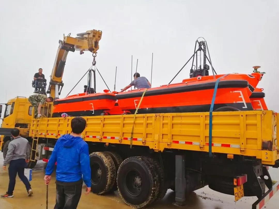
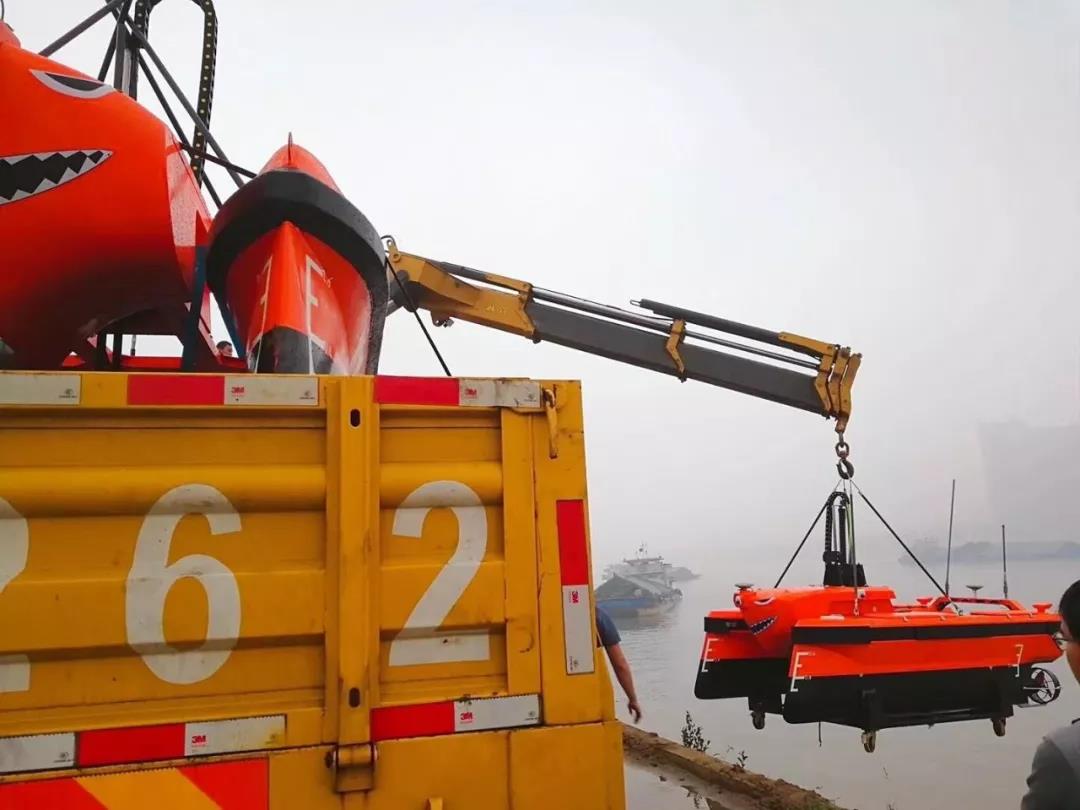
When surveying the watercourse in Foshan, the base station and communication antenna are set up under the Longwan bridge to ensure the signal coverage of both reaches. After simple tests, the unmanned boats receive commends from the base station and start working. It took the boats five hours to complete the task at an average speed of four knots.
As the unmanned boats docked, they’re collected by hooking the hanging point to the hook of the crane.
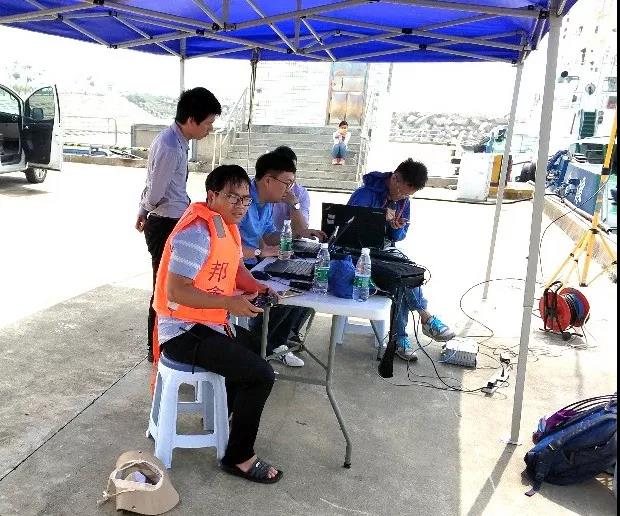
Operators working under the bridge
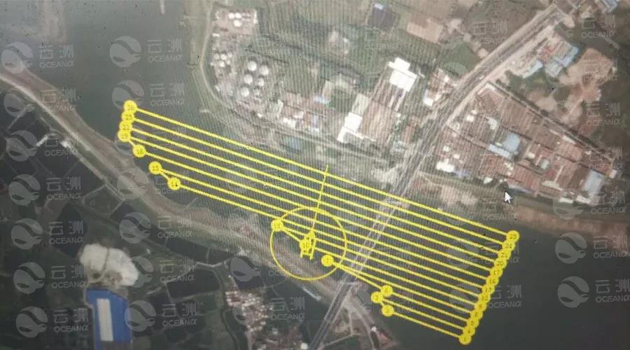
The survey line of the unmanned boat set on the base station
Ping 3D side scan sonar performance analysis
As can be seen from the real-time data, the data points of the 3D side scan sonar have high density and the output image is clear and delicate. The sonar with a span widths of up to 10 times the water depth greatly improves the survey efficiency and accuracy.
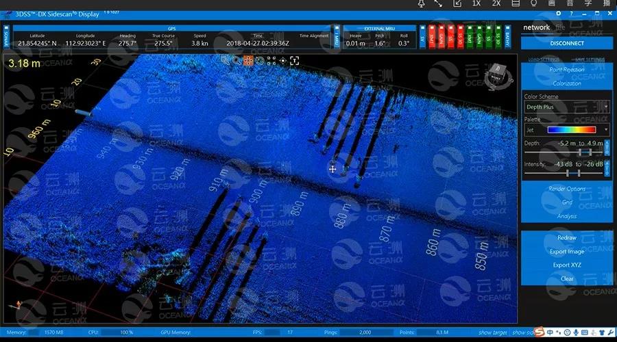
Dock piles in Taishan harbor
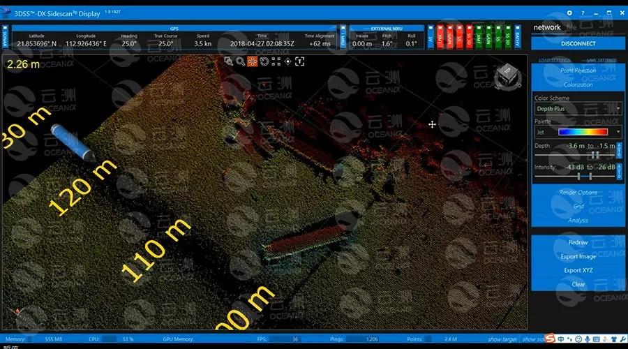
The breakwater and waste immersed pipes in Taishan harbor
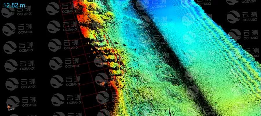
Bridge pier of Longwan bridge
MS400 multibeam performance analysis
1.Cross-section matching analysis
After correcting and calibrating the sensor data, we check the matching situation of the cross-section of Foshan watercourse and Taishan harbor respectively and get satisfying results.
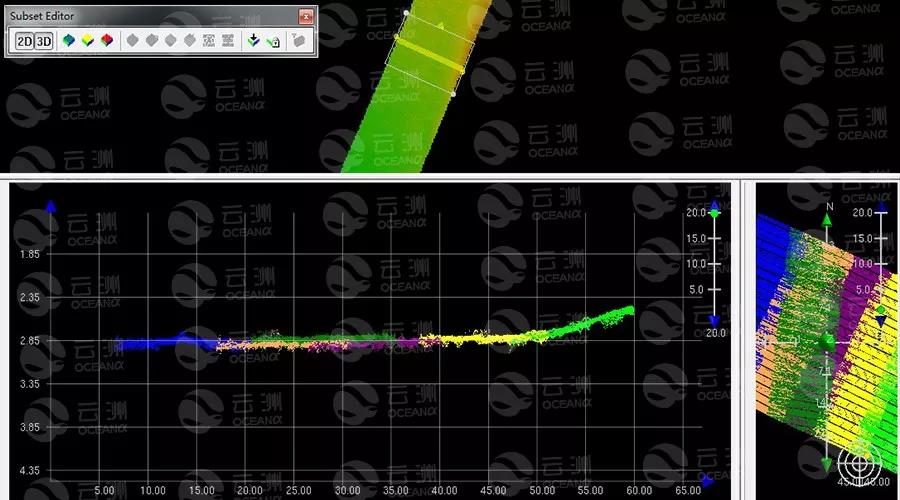
data matching output of Taishan harbour
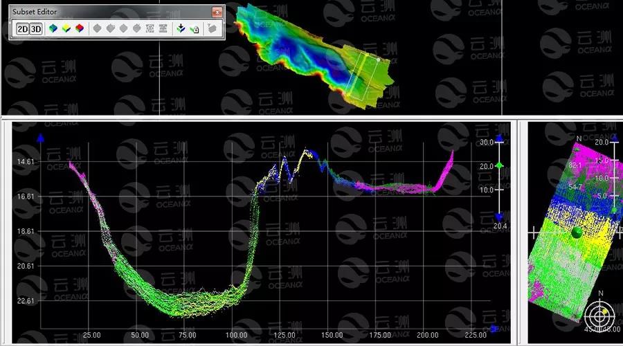
data matching ouput of Foshan watercourse
Using the quality control function that comes with the CARIS software, we analyze the accuracy of the data of overlapping area based on the IHO super-accuracy standard.
The terrain of Foshan watercourse is complex and the topography changes frequently, to demonstrate the survey result accurately, we process the statistical analysis with a square mesh size of 0.1 m. The result is as followed:
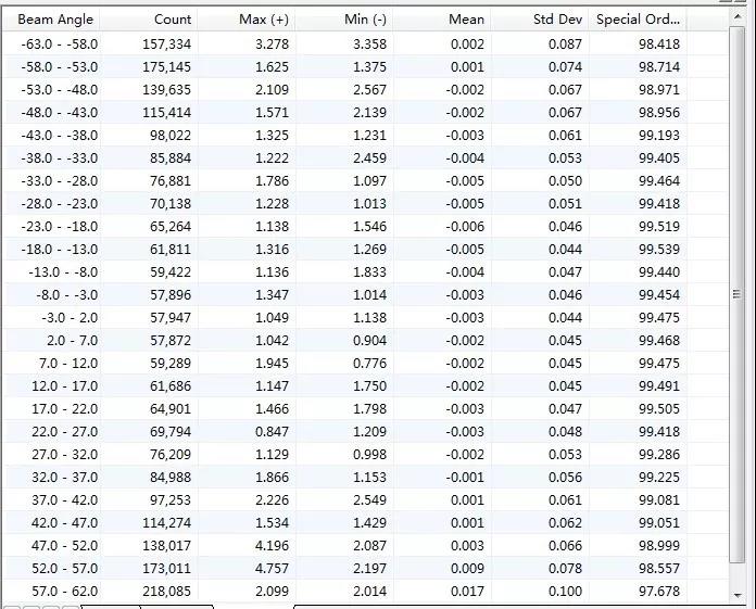
The analysis result with mesh size of 0.1 m
From the above table, we can see that all data within the measuring area meet the accuracy standard.
Since the underwater topography of the Taishan harbor is relatively flat, we establish the statistical analysis of mesh size of 0.1m*0.1m and 1m*1m respectively. The results greatly excel the IHO measurement accuracy standards.
The survey area includes both the upper and lower reach of the Longwan bridge and is of approximately 1 square kilometer and the water depth ranges from 2 to 5 meter.